Link of the Day: Interactive Map of Photographs of Old San Francisco
OldSF project shows how the city changed since 1850.
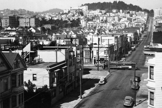
American developers Dan Vanderkam and Raven Keller created OldSF, an interactive map that shows San Francisco in 19th and 20th centuries, The Next Web writes.
To create the map they used images from the San Francisco Historical Photograph Collection.
Users can set the range of years for the photographs from 1850 to 2000.
{“img”: “/wp-content/uploads/2015/09/map_01.jpg”, “text”: “”},
{“img”: “/wp-content/uploads/2015/09/map_02.jpg”, “text”: “”}