Google revealed all Russian strategic and military sites on its maps
Since the beginning of the full-scale invasion of Ukraine, an online mapping tool Google Maps stopped concealing secret bases of the Russian Armed Forces. They are available in HD, according to the Ukrainian Defense Ministry news agency ArmyInform.
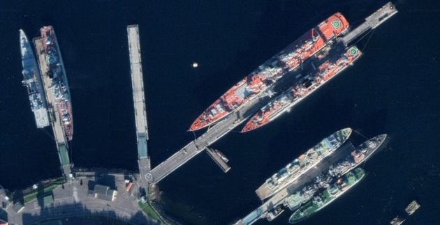
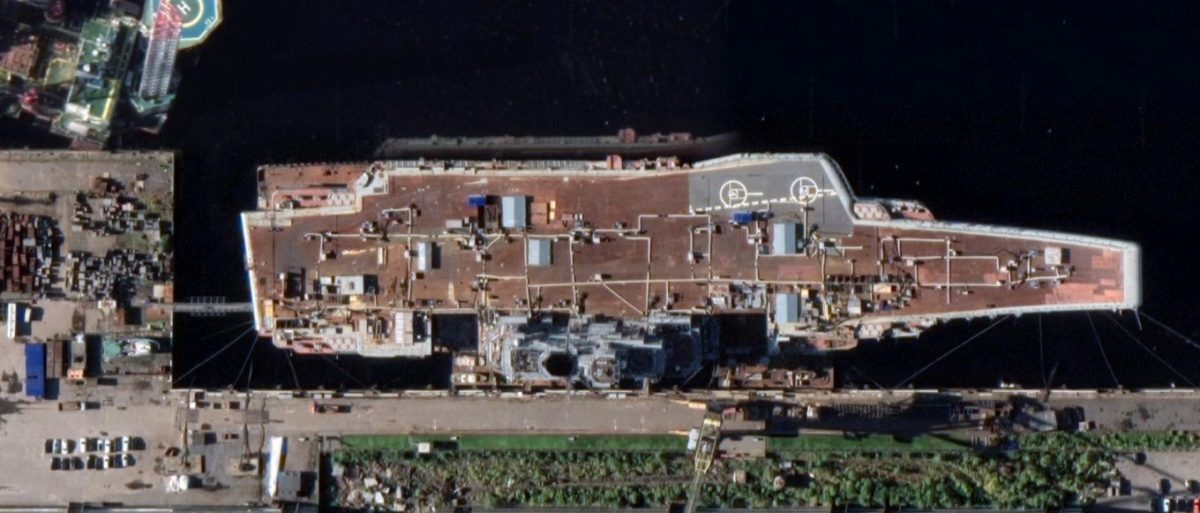
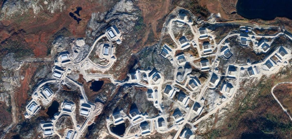
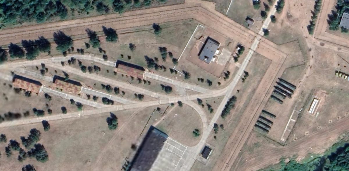
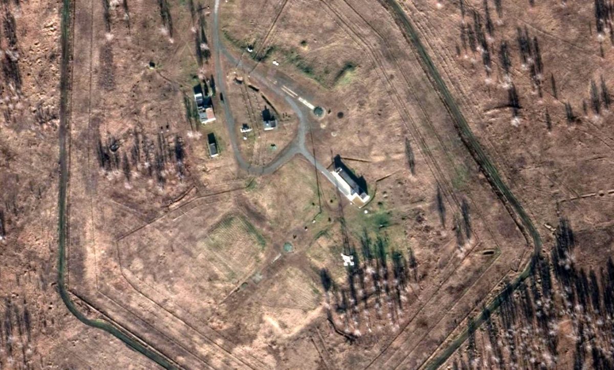
The agency draws attention to the various intercontinental ballistic missile launch facilities, command posts, secret polygons etc., which one can zoom in up to 50cm/pixel resolution. Previously, it was available at a much lower resolution that made detailed scrutiny virtually impossible.
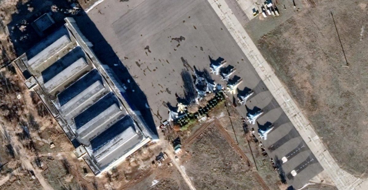
For instance, now one can see an Admiral Kuznetsov aircraft carrier, a nuclear ammunition base near Murmansk, a Russian SU-57 fighter jet in a flight test centre, as well as an intercontinental ballistic missile launch site.
Зображення: «АрміяInform»

Зображення: «АрміяInform»
Зображення: «АрміяInform»
Зображення: «АрміяInform»
Зображення: «АрміяInform»
Зображення: «АрміяInform»
The agency states that for most internet users these images have hardly any strategic value as the military satellites are already providing a better resolution. “However, at the same time there are some people that for sure will get interested in “wondering around” the secret Russian spots in Google Maps, and, perhaps, try finding the very putin bunker,” it adds.
Earlier on, the Ministry of Internal Affairs of Ukraine has collaborated with Google on a project to digitize Russia’s war crimes. The information will be publicly available on Google Maps.