Photographer Makes Different National Flags from Satellite Images
Max Serradifalco finds images of different regions of the Earth on Google earth and turns them into bright collages.
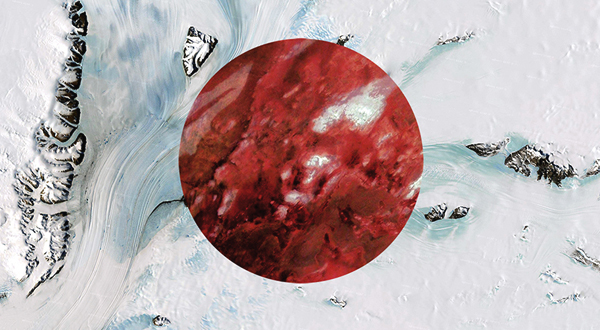
Max Serradifalco, an Italian photographer, presented a series of collages, All Colors of The World, where he recreates the colors of different national flags with the help of satellite images from Google Earth.
For instance, to form an Italian flag, the author combined landscape photographs of Qatar, Antarctica, and Namibia, and for the Belgian flag he used photographs of Iceland, Syria, and Australia.
“Let’s imagine a world where people belong to the earth, without taking into consideration the country they were born. A world where we are all brothers that share in the diversity, joy, color and energy of life, — Serradifalco says in the description of his project.