High Resolution Satellite Images are Made Public
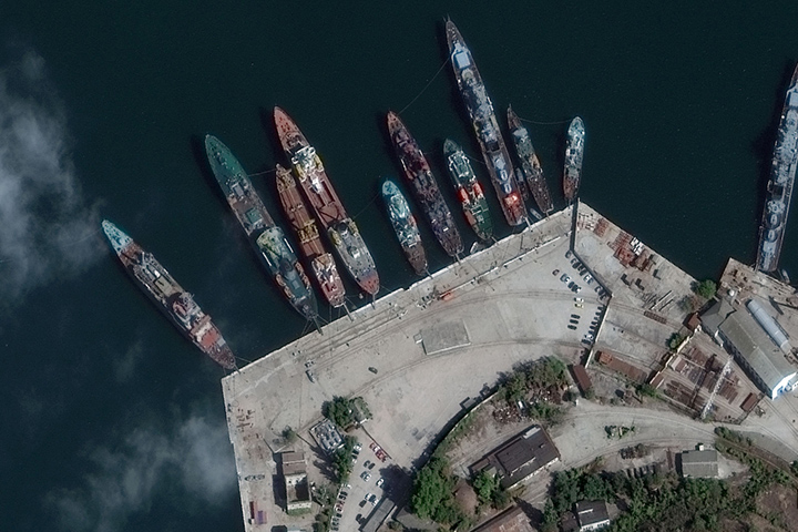
Last Thursday, Digital Globe, an American operator of civil satellites (including Worldview-3) of the Earth’s orbit opened access to high resolution satellite images (each pixel of an image covers 30 cm of the Earth’s surface) for internet users.
Previously, the detailed images were used exclusively by the US government. Recently the restrictions were lifted. Digital Globe announced that the images are available for sale.
“30 cm imagery brings new value to a variety of uses and market segments including mining, oil and gas, civil government, social/mobile/location services, and even global development organizations. This new level of value means better operational efficiency and cost management, more effective disaster planning and recovery, a better customer experience in consumer-facing, map-centric market segments, and more efficient humanitarian assistance,” writes Digital Globe.
{ “img”: “/wp-content/uploads/2015/02/30cm_01.jpg”, “text”: “” },
{ “img”: “/wp-content/uploads/2015/02/30cm_02.jpg”, “text”: “” },
{ “img”: “/wp-content/uploads/2015/02/30cm_03.jpg”, “text”: “” },
{ “img”: “/wp-content/uploads/2015/02/30cm_04.jpg”, “text”: “” },
{ “img”: “/wp-content/uploads/2015/02/30cm_05.jpg”, “text”: “” }