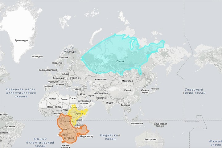
Infographic of the Day: The True Size of Countries on the Map
American web-developers James Talmage and Damon Maneice created a website The True Size, which shows the real size of countries, without distortion inherent to cartographic projections.
To see how the territory of a certain state compares to that of the other states, you need to enter the name in the search bar: the boundaries will be highlighted in color, after than you can drag and drop the figure.
For instance, if you move the projection of Russia’s territory closer to equator, it will turn out it is several times smaller and will occupy the territory of roughly half of Africa only. Greenland, which also seems similar in size to Africa on the map, turns out to be 14 times smaller.
Such distortions, which visually increase the size of countries, are caused by the fact that most modern maps are based on the cylindrical Mercator projection. It causes the vertical stretching of territories, which are closer to the poles.